
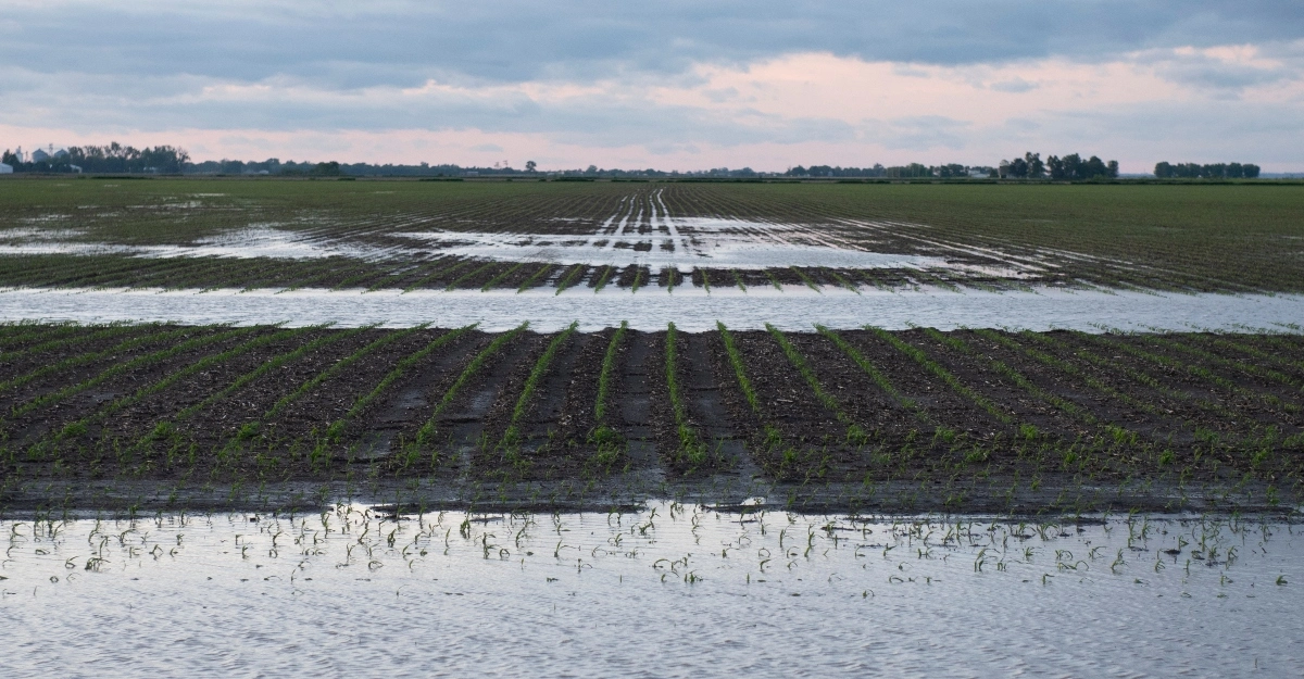
According to the United States Geological Survey, 71% of Earth’s surface is covered by water. So, why worry about water resources if they are so abundant? The main reason is aquifers are being pumped faster than rainfall and snowmelt can recharge them, especially in agricultural regions (e.g., the Ogallala Aquifer and the Central Valley in California).
Once depleted, some aquifers take centuries to refill, or never fully recover because pumping causes the underlying rock layers to compact (subsidence), permanently reducing storage capacity. Here is a breakdown of where Earth’s water is located:
- Oceans: 96.5% (Saltwater)
- Ice Caps and Glaciers: 1.7%
- Groundwater: 1.7%
- Atmosphere, Rivers, and Lakes: Less than 1%
So, only 3.5% of the planet’s water is considered fresh water. This may sound alarming until you think about the sheer volume of water we are talking about. We can’t utilize the water frozen in ice caps and glaciers in agriculture, so let’s just talk about the groundwater.
There are roughly 2 million cubic miles of water stored in the ground, mostly within one-half mile of the surface. One cubic mile of water is equal to more than 1.1 trillion gallons. While math is one of our strengths, this volume of zeroes is a bit overwhelming.
This is where Earth’s fresh water is located.
- Ice Caps, Glaciers, and Permanent Snow: 68.7%
- Groundwater: 30.1%
- Ground Ice and Permafrost: .86%
- Freshwater Lakes: .26%
- Other: .08%
Ogallala Aquifer
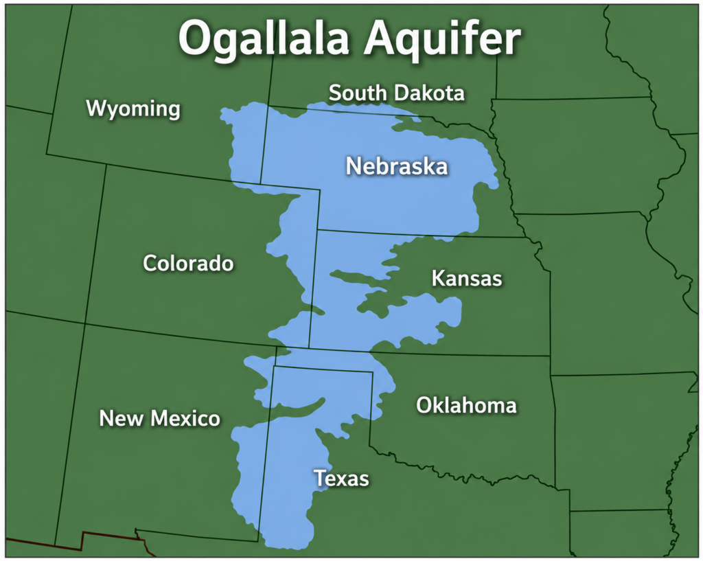
One of the most significant sources of groundwater in the United States is located just west of us in the Ogallala Aquifer. For more than half a century, the American Midwest has functioned as the breadbasket of the world, its corn, soybean, and wheat fields fed by an invisible reservoir buried hundreds of feet underground.
This reservoir stretches beneath eight states from South Dakota to Texas and has quietly fed one of the most productive agricultural systems on Earth.
We generally refer to this region as the High Plains. Before irrigation became widely used following World War II, this region mostly supported dryland crop farming and livestock grazing. Very little of the area where we manage farms is fed by the Ogallala Aquifer.
What About Iowa?
Iowa is not Kansas or Nebraska. Iowa has long been described as the land between two rivers, bordered by the Missouri on the west and the Mississippi on the east, with a dense internal network of tributaries, alluvial aquifers, and bedrock formations beneath. It does not sit atop a slowly vanishing fossil aquifer, and farmers here do not lie awake worrying that the well will run dry.
With roughly 35 inches of annual precipitation and a relatively shallow water table in much of the state, Iowa has historically had little reason to worry about water quantity. Many parts of the state utilize drainage tile to remove excess amounts of water after rain events.
This may seem strange to some just one state away. Nebraskans are pumping water onto their farms while many Iowa farmers find ways to remove it.
How is Iowa’s Abundant Resource Used?
Below is a chart of Iowa’s water usage according to the Iowa Geological Survey at the University of Iowa. As the chart illustrates, agriculture is not a significant portion of water usage in Iowa.
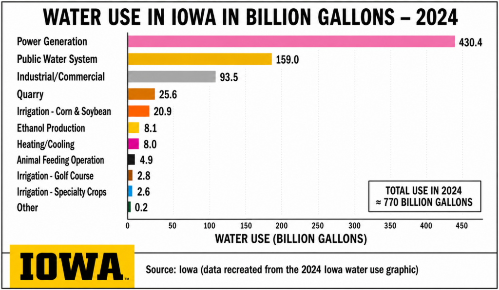
As the chart illustrates, agriculture is not a significant portion of water usage in Iowa. In 2025, there were 1,578 crop irrigation permits, 150 animal feeding operations, and 32 ethanol plants with registered water use permits.
Compare that to 20 Power Generation permits using over half of the total water. (Iowa Geological Survey)
An Emerging Quantity Problem: Data Centers and New Demand
While nitrate dominates the headlines, a newer concern is building in the background. Iowa’s water resources are now drawing interest from an unexpected sector, largescale data centers, whose cooling systems can require substantial water withdrawals.
County associations and water utilities have flagged the tremendous demand for water associated with the rapid growth of data centers across the state as a top emerging priority, one that Iowa’s regulatory framework, designed decades ago around agricultural and municipal use, was not built to anticipate.
A Different Kind of Water Story
Iowa’s relationship with water resources doesn’t fit the dry, dramatic narrative of a vanishing western aquifer. It’s a quieter and in some ways more complicated story: a state with genuinely abundant water that is discovering that abundance attracts new claims on that water from industries the state never had to regulate before.
The lesson geologists and planners are drawing from Iowa is that water security isn’t only a question of how much water exists underground.
It’s also a question of what’s in it, who else wants it, and whether the institutions managing it were built for the century they’re operating in.
Partner with Stalcup Ag Services
If you want to discuss water topics, farm management, or something else, reach out to one of our staff members, and we’d love to meet with you.
More From Today’s Land Owner Summer 2026: