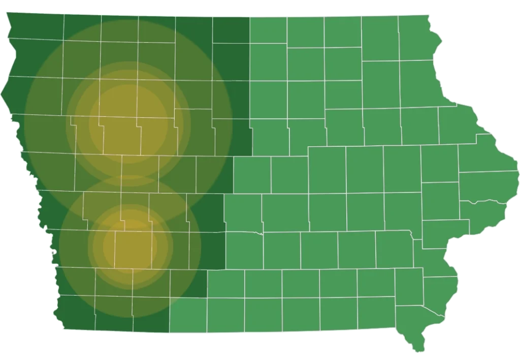
It has been an interesting month for weather in the area. The theme has been variability. The only general rain we have received was in the first week of August. This was a critical rain that kept some very dry areas going. Since then, rains have been uneven. Beginning in late June, the area north of highway 18 started getting good rains, and these have continued through last week. This area currently has abundant soil moisture, and crop conditions are excellent. South of this line, rain has been harder to come by. Some areas have received just enough to maintain good conditions, while others just a few miles away are showing moisture stress. One factor that has kept us going in the face of significant rainfall deficits is temperatures. We have been fortunate since early August to have mostly below normal temperatures, and most critically, cool nights that allow the crops to “catch their breath”. Without these favorable temperatures, yield prospects would be much less.
Currently the corn is mostly in the early dent stage and at least 3 weeks from maturity. Pollination was good in all areas; but in the moisture stressed areas, ear length is shortened as kernels have aborted on the end of the ear. In most cases this hasn’t been as much as expected thanks to moderate temperatures. Some additional rain in the near term could add some kernel weight, but we are pretty close to having our corn yield determined. In the wetter areas to the north, yield should be excellent barring a late season wind storm or early frost. Other areas can still expect average yields while the driest areas will struggle. Just one rain missed will make a big difference this year.
The soybeans are still mostly green. I’ve been impressed with the plant health this year. Most plants are in the pod fill stage, but some are still trying to add late pods. The wettest areas to the north will be successful in this while most areas will likely not add pods without a good rain in the near term. All plants can still benefit from some rain to add to bean size. I think an average soybean yield can still be achieved if we received this rain over the next ten days, otherwise we will lose some potential.
Grain markets have been influenced as usual by growing season weather. Like last year, it is shaping up as a year of haves and have nots. The western corn belt has suffered all summer with below normal rainfall and mostly above normal temperatures , and crop prospects in these areas are not good. The eastern corn belt has been wetter, but conditions don’t look as good there as last year. The best area looks to be a good share of Illinois, the northeastern 40% of Iowa, and southern Minnesota, where they may be looking at some of the best yield prospects ever. Overall, the USDA currently estimates corn yields at 175 bu/acre and soybeans at 52 bu/acre. The widely followed Pro Farmer crop tour is taking place this week, which will add some “boots on the ground” clarity to the USDA computer and survey generated estimates. Early reports are highlighting problem areas on the western and eastern sides of the corn belt and are helping to boost prices. Weekly crop condition reports from the USDA show the corn crop rated the lowest since the drought year of 2012, (although much better than that year), which is also giving some strength to the markets.
Please click on the button to the right to view the past Crop Conditions reports.
Stay informed and connected—subscribe to our mailing list today to receive the latest issues of Today’s Land Owner, Crop Updates, or get notified of auctions and real estate for sale, sent directly in your inbox!